

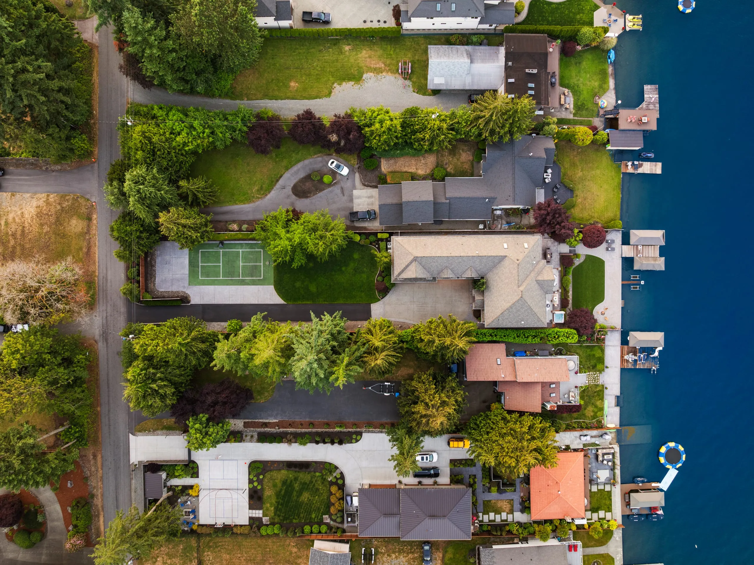
Drone Photography in Bellevue: Aerial Stills, Flown Legally
Photos delivered by noon the next day, or the shoot is free.
- Over $2 billion in real estate photographed
- Photos delivered by noon the next day
- 4.9★ average rating on Google
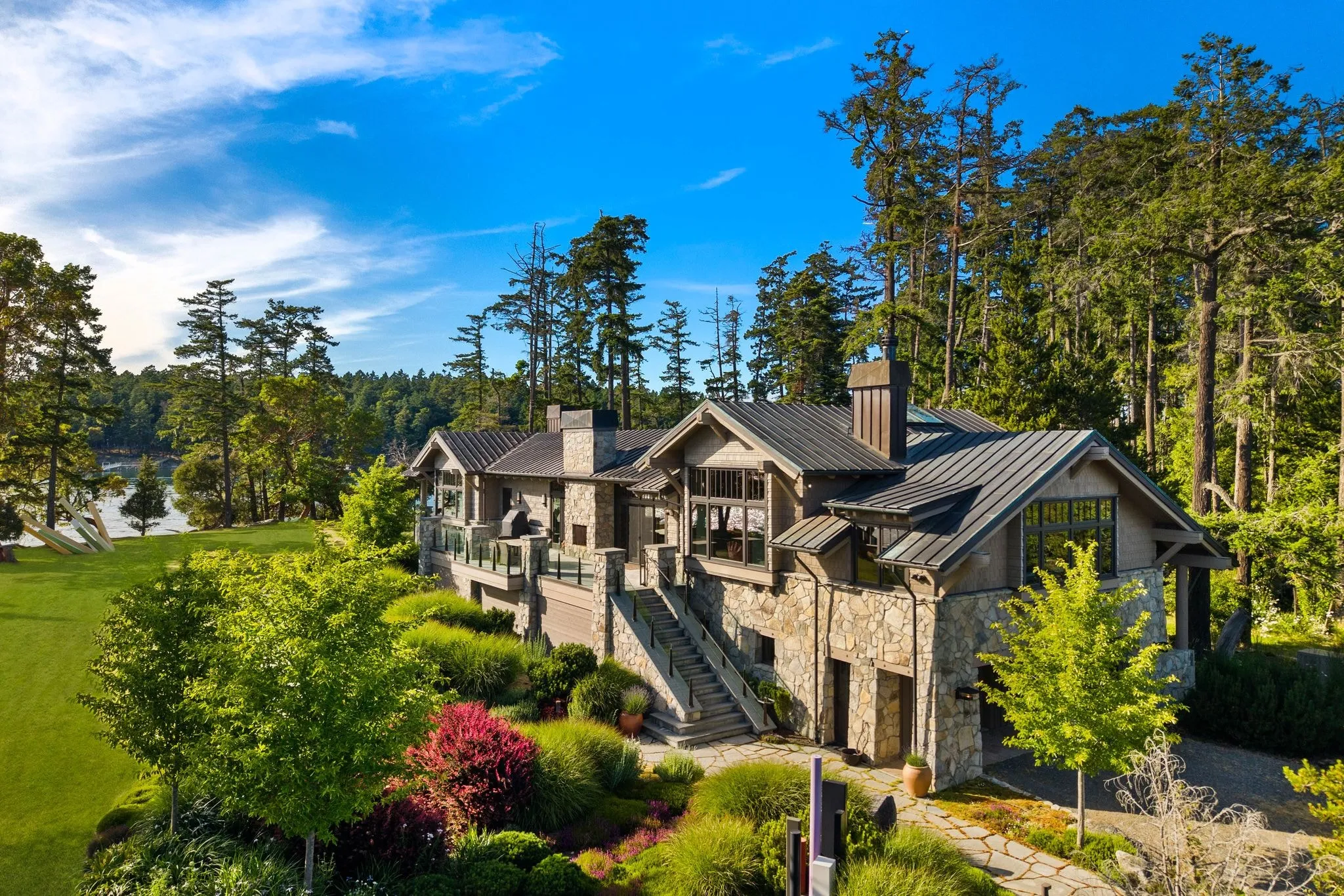
Deciding When a Listing Needs Aerial Coverage
Aerial coverage matters most when a listing’s value is tied to its lot, its view, or its surroundings, not just its rooms. Bellevue has plenty of those. Some listings just do not need it, and we will tell you when that is the case.
Some listings sell themselves from the sidewalk. Others do not show what they are worth until you are forty feet up.
Around Meydenbauer Bay and the West Bellevue waterfront, lot position is half the pitch. A buyer scrolling photos wants to see how close that backyard sits to the water, and ground level cannot show that. Same story in Somerset, where hillside lots trade on view corridors that a street shot flattens into nothing.
- Large or irregular lot where boundaries and usable yard space are not obvious from the ground
- Water proximity, territorial view, or a hillside lot where elevation is the selling point
- New construction where nearby development or lot context matters to buyers
- Corner lots or unusual shapes that street photos compress and confuse
- Listings under mature tree canopy, common on older Eastside streets, where ground shots get blocked
Now, a one-bedroom condo with no view and no yard? Skip it. If there is nothing outside the walls worth showing, an aerial shot will not add much and we will say so.
Our pilots are FAA Part 107 certified, so flights over Bellevue neighbourhoods are done within the rules, not around them. That matters more than agents realise, and it is one less thing for you to think about before the shoot.
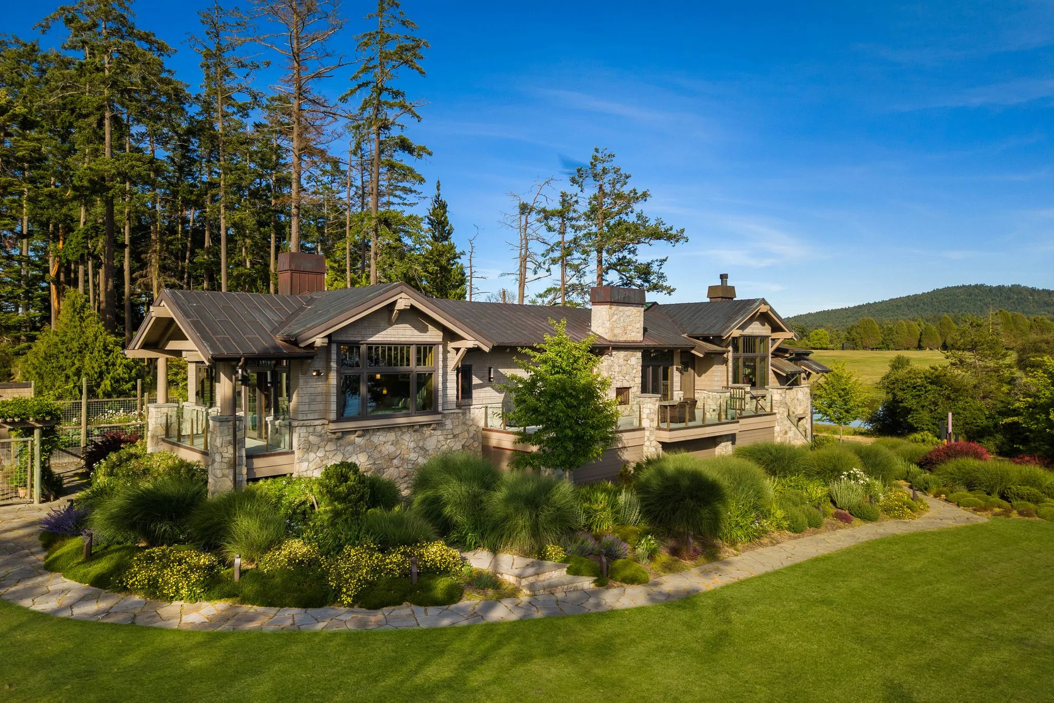
Bellevue’s Airspace and Permit Rules
Bellevue sits inside a web of federal, local, and site-specific rules that make casual drone use riskier than most homeowners or agents realise. Because the city is close to Seattle-Tacoma International Airport and several smaller regional fields, much of Bellevue falls under FAA-controlled airspace. In practice, this means a pilot generally needs LAANC authorisation, a real-time system that grants or denies clearance to fly at a specific altitude in a specific grid, before a drone ever leaves the ground. Fly without it, and you are not just breaking a rule, you are operating illegally in controlled airspace.
The downtown high-rise corridor near NE 4th St is a particularly well-known headache. Tall buildings, dense pedestrian traffic, and proximity to controlled airspace combine to make authorisation slower and sometimes outright denied for that specific grid square, even for small, lightweight drones that would be uncontroversial elsewhere in the city. Listings in this corridor often require a pilot who already understands which blocks are realistically flyable and which will stall a shoot for days waiting on approval that never comes.
On top of federal airspace rules, the City of Bellevue publishes its own local guidance on drone operation, including restrictions near parks, city facilities, and other public spaces. A property backing onto a greenbelt or sitting near a popular park may look straightforward from the ground, but it can carry its own layer of local restriction that has nothing to do with the FAA.
- Controlled airspace near Sea-Tac and regional airports typically requires LAANC approval before takeoff
- Downtown Bellevue’s NE 4th St corridor is known for slower or denied authorisations due to building height and density
- The City of Bellevue maintains separate local rules for parks and public property
- Authorisation requests can take anywhere from seconds to several days depending on location and grid
This is precisely where a licensed, insured Part 107 pilot earns their fee. Part 107 certification means the operator has passed an FAA knowledge test covering airspace classification, regulations, and safe operating procedures, and stays current on rule changes. A working pilot in this market already knows which downtown blocks are realistically permittable, has active LAANC accounts ready to submit requests immediately, and carries liability insurance that protects the agent, the seller, and the property if anything goes wrong. Agents do not need to become airspace experts, they simply need to hire someone who already is.
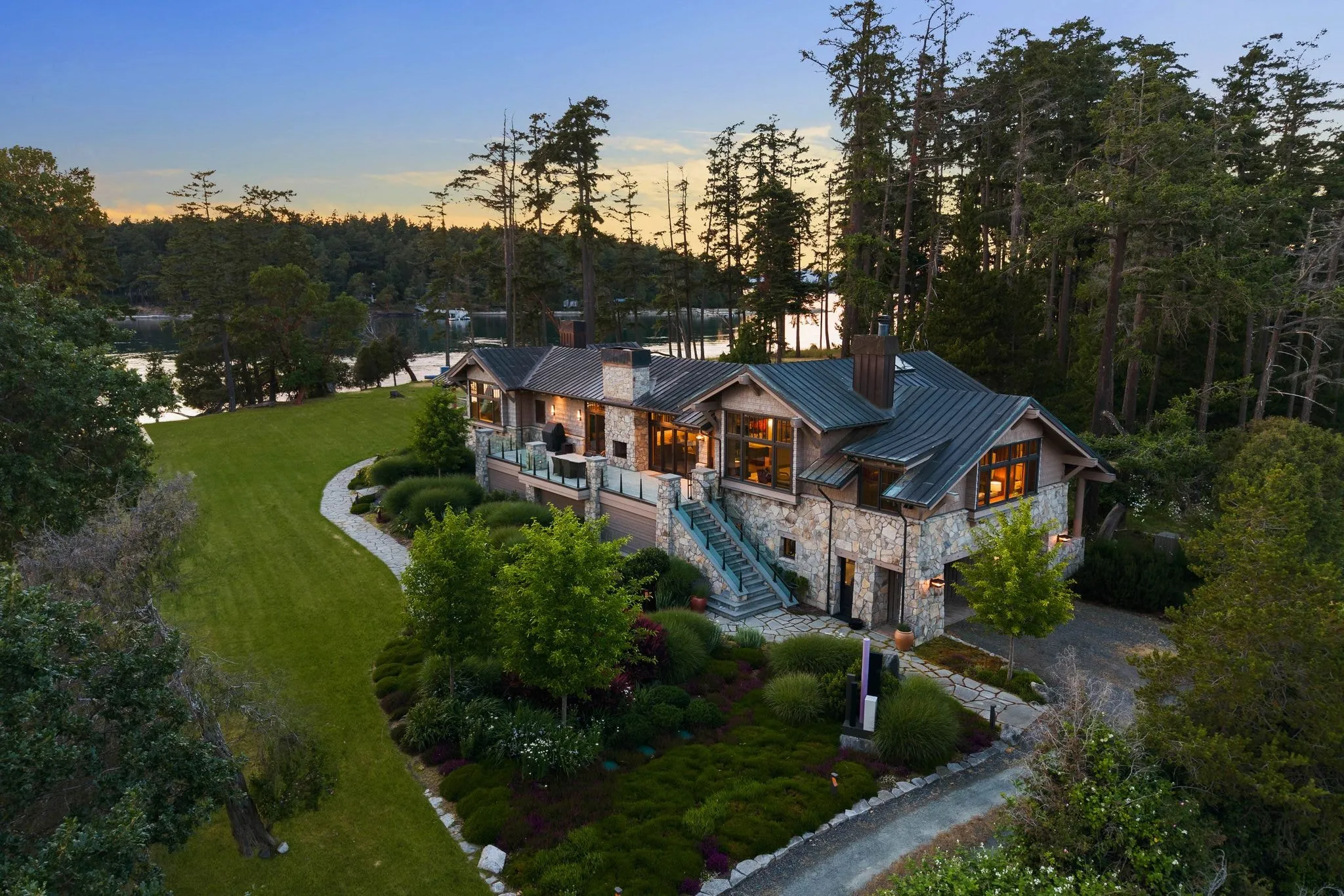
Large Estates and Waterfront Lots That Need Aerial Scale
Bellevue’s most valuable properties often sit on parcels large enough that a buyer standing in the driveway simply cannot see what they are purchasing. In neighbourhoods like Bridle Trails, where zoning has preserved large, horse-friendly lots and mature tree cover, ground-level photography flattens the very thing that makes the property special. A one-acre or two-acre estate with a private paddock, riding access, or a long gated driveway looks, from the street, like any other house. Aerial photography solves this by pulling back far enough to show the full footprint: where the fence lines run, how the structures relate to the pasture or barn, and how much usable land surrounds the home.
Waterfront and near-waterfront homes along the Lake Washington-adjacent pockets of Bellevue face a related but distinct challenge. Buyers shopping in this tier care intensely about proximity to the water, shared or private dock access, and how a lot’s boundaries sit relative to the shoreline. A drone shot taken at the right altitude can show the walking distance to the water, the angle of a view corridor between neighbouring homes, and whether a lot has direct frontage or an easement path. These are details that listing descriptions try to explain in words but that buyers trust far more when they can see them.
- Full-lot establishing shots that show acreage, fencing, and outbuildings in one frame
- Low-altitude passes that trace private driveways, gated entries, and equestrian access points
- Shoreline proximity shots that clarify walking distance and view lines to Lake Washington
- Boundary-context imagery that helps buyers understand adjacent land use and privacy buffers
- Golden-hour aerial sequences that highlight both the home and its surrounding landscape
These situations are exactly why large estate aerial photography and aerial real estate photography exist as distinct offerings rather than a single generic drone package. Large estates need a shooting plan built around perimeter coverage and land features, while waterfront listings need flight paths that respect shoreline setback rules while still capturing proximity and view value. Matching the right approach to the property type is what turns aerial imagery from a nice-to-have into a genuine listing advantage.
Scheduling Around Puget Sound Weather
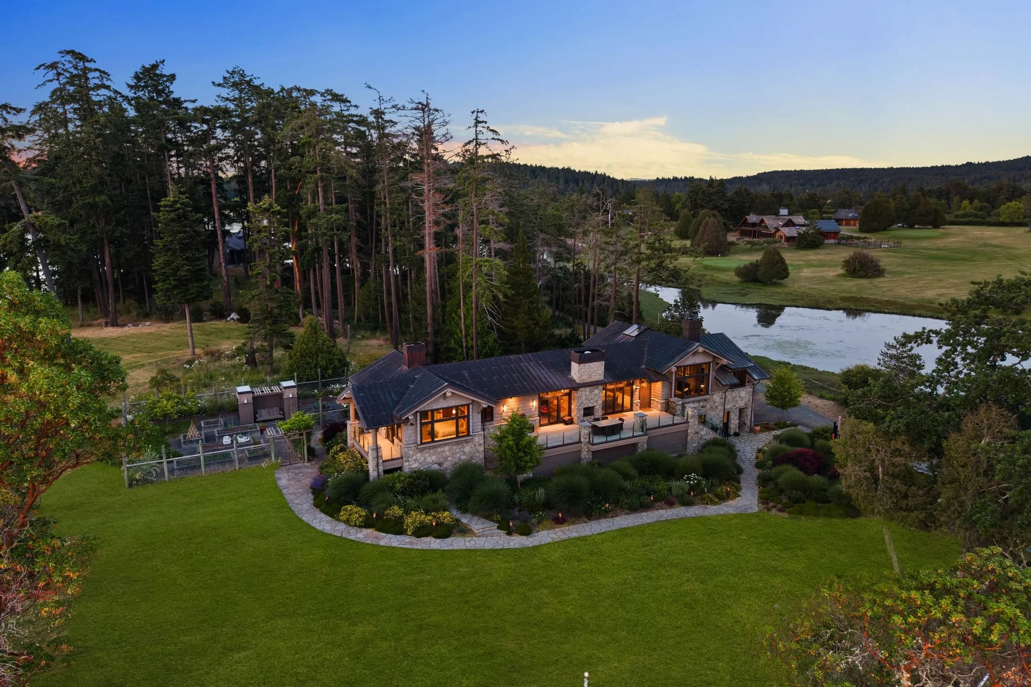
Bellevue sits under marine air off Puget Sound, so grey skies and low cloud ceilings show up a lot between October and April. That matters for drone work. A ceiling under 400 feet grounds a flight before it starts, and our FAA Part 107 pilots follow visibility and wind limits every time, no exceptions.
We watch the forecast days out, not hours out. Wind gusts off Lake Washington can pick up fast in the afternoon, so morning flights are usually the calmer bet on the Eastside.
Here is what drives the scheduling call for your listing:
- Cloud ceiling and visibility, checked the morning of the flight
- Wind speed, since gusts near Lake Washington build through the day
- Season, with clearer windows more common June through September
- Twilight timing, which shifts earlier in winter and later in summer
- Tree canopy around the property, common on Bellevue’s older lots
So if your listing goes live in January, build in a flexible window. We would rather move your flight two days than hand you footage shot in flat, hazy light.
And if the forecast flips the morning of the shoot? We reschedule fast, usually within the same week.
One thing agents ask a lot: can we just shoot through light rain? No. Wet lenses and low visibility ruin the shot before it is taken.
Book your drone coverage when you book your photo shoot, not after. That gives us the widest window to catch clear skies before your listing date.
What a Professional Drone Shoot Includes
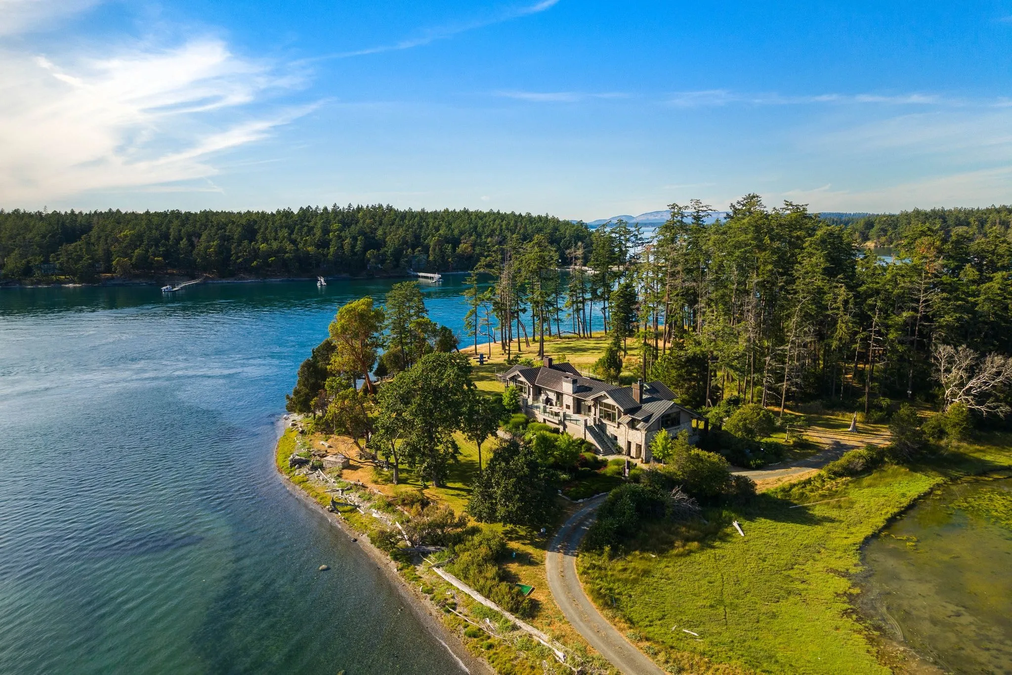
A professional drone shoot in Bellevue is rarely a standalone service. It is almost always built as a layer on top of a standard real estate photography package, designed to show context a ground-level camera cannot capture: lot boundaries on a wooded Somerset half-acre, proximity to Lake Washington in Meydenbauer, or how a Newport Shores property lines up with the water. A well-run shoot follows FAA remote pilot rules, checks local airspace, and times flights around wind and light rather than just convenience.
- Aerial stills: typically 8 to 15 high-resolution images covering front elevation, lot lines, roofline condition, neighbourhood context, and proximity to parks, greenbelts, or water
- Drone video and cinematography: smooth establishing shots, reveal flyovers, and orbit sequences edited into a 30 to 90 second clip, often used to open a full property video tour
- Twilight aerial option: a dusk flight capturing the home and skyline with interior lights on, popular for higher-end Bellevue listings in Bridle Trails or the downtown high-rises
- Delivery folded into the listing photo package: aerial stills and clips are edited, colour-matched to the ground photos, and delivered together in one online gallery rather than as a separate download
The twilight aerial option deserves a specific note: it requires a second, separately scheduled flight near sunset, which means more setup time and a narrower weather window, especially during Bellevue’s overcast winter months. Agents listing waterfront or view properties often request it specifically because dusk lighting makes lake reflections and city lights read dramatically in both stills and video.
Cost for drone coverage is almost never a flat, universal rate. It is structured as an add-on priced by scope: lot size and complexity, how many flights are needed, and whether the client wants stills only, video only, or both. A quarter-acre lot in Wilburton with a single still-image flyover costs far less than a multi-acre estate requiring several flight paths plus a twilight video sequence. Ask for current figures by property rather than assuming one number applies to every listing. Coverage scales up through the full range of Bellevue aerial photography services as the parcel grows.
Frequently asked questions
How do I know if my Bellevue listing needs drone photography?
Do you need special permission to fly drones in Bellevue?
What parts of Bellevue are hardest to get drone approval for?
Are your drone pilots licensed and insured?
What happens if the weather is bad on my scheduled shoot day?
Ready to book your Bellevue shoot?
Tell us the address and the square footage. We’ll give you a price and a time slot on the same call.